Everything happens in a place
Years ago, when I was a teacher, we had an influx of Polish children to our school. After a couple of weeks, one of the senior leaders gave the new pupils a map of the school and asked them to add a smiley face, a neutral face, or an unhappy face depending on how they felt about those spaces. Many of them couldn’t speak English, so it was a really important way of starting to figure out how, where, and why they were feeling included or excluded.
I was reminded of this when reading this post about “maps as conversations”. It’s a way of understanding how different groups understand and move through spaces. It’s a way of having multiple maps of the territory, rather than just the official versions.
I’m having a chat with Tom Watson, one of the authors next week, so I’m looking forward to finding out more. Especially as one of the areas used as an example is Sheffield, where I went to university as an undergraduate.
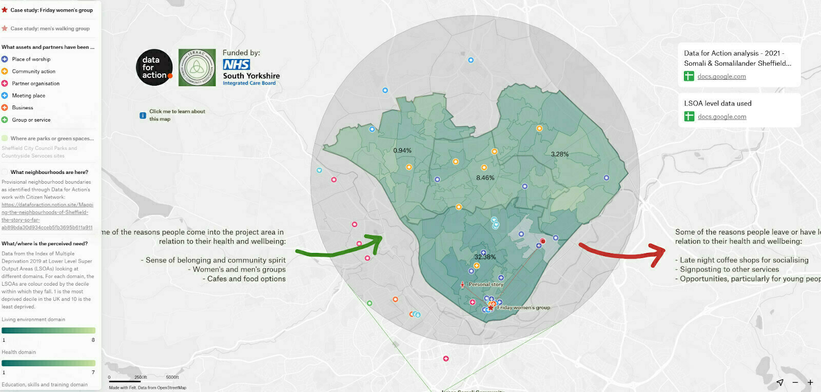
What started as an idea that “everything happens in a place” has turned into a practical, replicable initiative. Through the power of citizen-led mapping, Sheffield’s communities have already begun to shift how we talk about places, how we deliver services, and how we make decisions together.
We think other areas now have the chance to adapt and benefit from this model. By grounding policy and practice in how people actually live, connect and identify, localities can cultivate greater participation, more cohesive relationships and a richer sense of community ownership.
Source: Data for Action
Image: (from the post}