
Informatics of domination
I’ve had this incredible interactive map, created by Kate Crawford and Vladan Joler, bookmarked for a while now. I’m never sure what to do with so much information in one place that isn’t primarily text-based.
I’m sharing it while still exploring it myself, with the hope that others will be able to find a use for it rather than be overwhelmed!
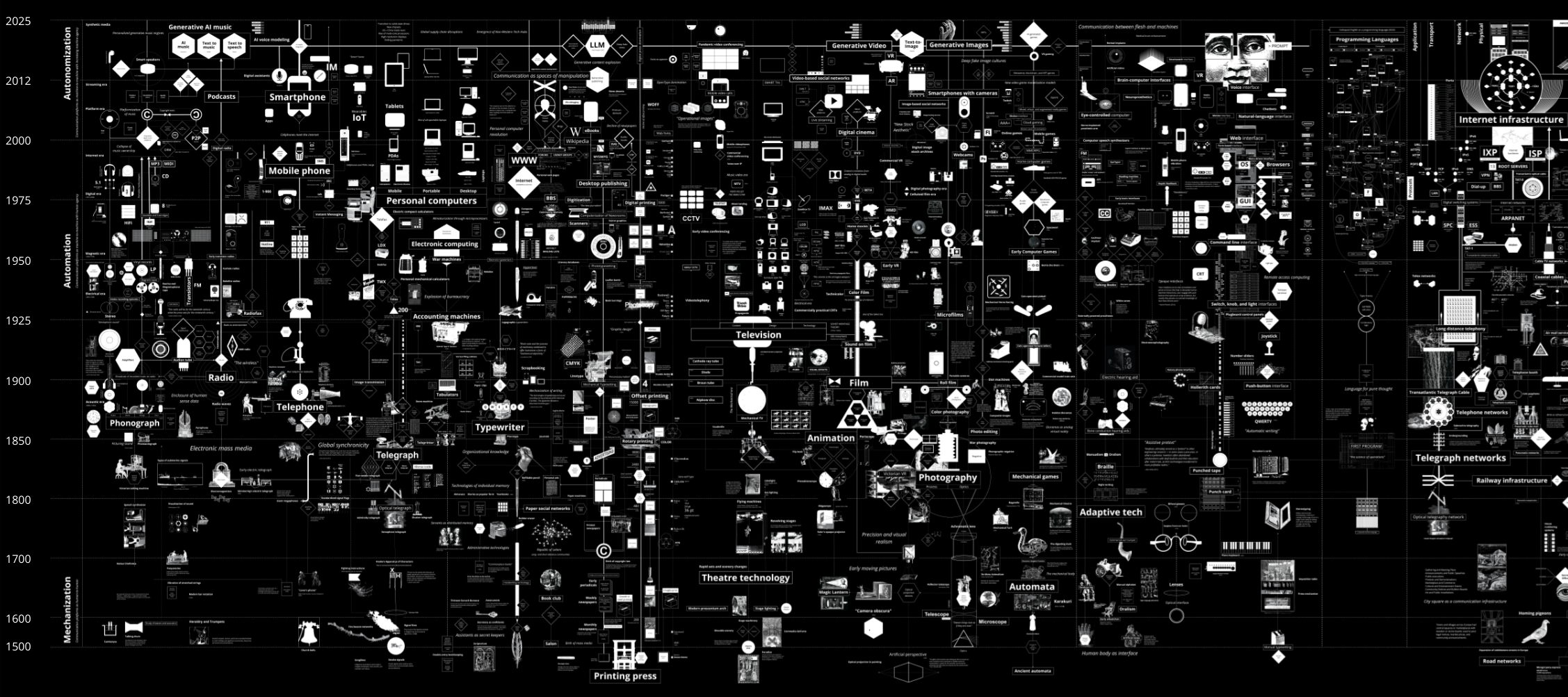
Calculating Empires is a large-scale research visualization exploring how technical and social structures co-evolved over five centuries. The aim is to view the contemporary period in a longer trajectory of ideas, devices, infrastructures, and systems of power. It traces technological patterns of colonialism, militarization, automation, and enclosure since 1500 to show how these forces still subjugate and how they might be unwound. By tracking these imperial pathways, Calculating Empires offers a means of seeing our technological present in a deeper historical context. And by investigating how past empires have calculated, we can see how they created the conditions of empire today.
[…]
Calculating Empires takes Donna Haraway’s provocation literally that we need to map the “informatics of domination.” The technologies of today are the latest manifestations of a long line of entangled systems of knowledge and control. This is the purpose of our visual genealogy: to show the complex interplay of systems of power, information, and circumstance across terrain and time, in order to imagine how things could be otherwise.
This work can never be complete: it is necessarily partial, subjective, and drawn from our own positionality. But that openness is part of the project. You are invited to read, reflect, and consider your own history in the recurring stories of calculation and empire. As the overwhelming now continues to unfold, Calculating Empires offers the possibility of looking back, in order to consider how different futures could be envisioned and realized.
Source: Calculating Empires: A Genealogy of Technology and Power Since 1500